File:EP-D1.2-Fig10bisC-Float-locations.png
Size of this preview: 756 × 600 pixels. Other resolutions: 303 × 240 pixels | 827 × 656 pixels.
Original file (827 × 656 pixels, file size: 236 KB, MIME type: image/png)
Summary[edit]
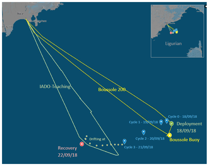
Deployment and recovery of the pCO2 profiling float prototype in the Ligurian Sea during BOUSSOLE/MOOSE/IADO-Teaching cruise. Blue symbols are the float's location at the end of each corresponding cycle.
File history
Click on a date/time to view the file as it appeared at that time.
| Date/Time | Thumbnail | Dimensions | User | Comment | |
|---|---|---|---|---|---|
| current | 05:20, 8 September 2020 | | 827 × 656 (236 KB) | Alexander Zilliacus (talk | contribs) | Deployment and recovery of the pCO<sub>2</sub> profiling float prototype in the Ligurian Sea during BOUSSOLE/MOOSE/IADO-Teaching cruise. Blue symbols are the float's location at the end of each corresponding cycle. Category:Images |
- You cannot overwrite this file.
File usage
The following page links to this file: