Science Demonstrator 8: Dynamic Ecological Information Management System - Site and Dataset Registry (DEIMS-SDR)
Please provide your feedback on this Science Demonstrator using the questionnaire at https://survey2.icos-cp.eu/ENVRIplus-evaluator!
Contents
Overview[edit]
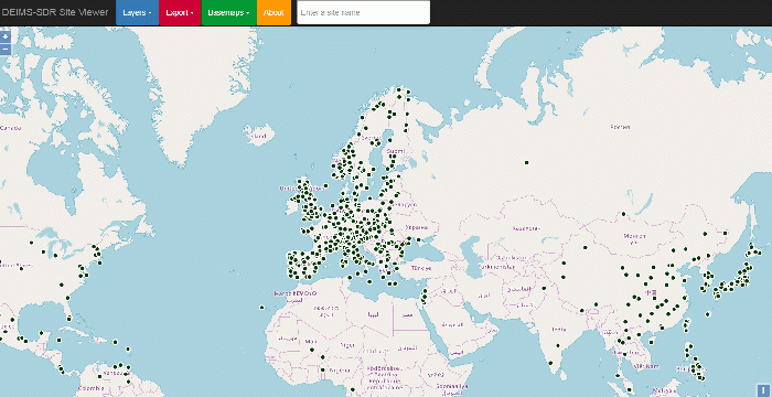
DEIMS-SDR (Dynamic Ecological Information Management System - Site and Dataset Registry; https://deims.org) is a web service that allows registering and discovering long-term ecosystem research sites around the globe, along with the data gathered at those sites and the people and networks associated with them. DEIMS-SDR describes a wide range of sites, providing a wealth of information, including each site’s location, ecosystems, facilities, parameters measured and research themes. It aims to be a globally comprehensive site catalogue of in-situ observation or experimentation facilities covering all (terrestrial) biomes and enabling that standardised information to be openly available to science, politics and the public in general.
Scientific Objectives[edit]
- Easy discovery of sites and their associated data
- Persistent, unique and resolvable identification of sites
- Allowing comparative analyses of registered sites and their networks
Description[edit]
Architecture[edit]
DEIMS-SDR currently consists of four main components fulfilling different needs and offering linked services:
- DEIMS Core: Provides a basic user interface for storing information about datasets and people and for generating respective metadata records
- DEIMS-SDR: An extension of DEIMS Core featuring additional custom-built modules that allow the storing of information about research sites, data products and sensors and the generation of ISO19139, SensorML and INSPIRE EF metadata records.
- WebGIS Service: An instance of GeoServer, an OGC compliant implementation of a number of open standards that exposes geographic information of sites as view and download services with additional rudimentary information about research sites, e.g. name, DEIMS.ID and the URL to the respective metadata record.
- Catalogue Service: DEIMS-SDR periodically loads all available metadata records into a pyCSW instance. pyCSW is a python implementation for the OGC Catalogue Service for the Web (CSW) server implementation that makes records harvestable by other systems.
Additionally, there are a number of Python and shell scripts that ease the process of moving information from one subsystem to another.

Service components[edit]
Due to the usage of pyCSW and GeoServer, a variety of OGC services are supported that allow data from DEIMS-SDR to be queried. Currently, the following services are supported:
- Web Feature Service (WFS)–an interface allowing requests for geographical features across the web using platform-independent calls
- Web Map Service (WMS)–a standard protocol developed by the Open Geospatial Consortium for serving georeferenced map images over the Internet
- Catalogue Service for the Web (CSW)–a standard for exposing a catalogue of geospatial records in XML on the Internet
- Open Archives Initiative Protocol for Metadata Harvesting (OAI-PMH)–a protocol developed for harvesting (or collecting) metadata descriptions of records in an archive.
The relation and interfaces of all software components are illustrated in Fig. 4. The support of WMS and WFS allows for on the fly usage of site information in desktop GIS applications, such as QGIS, or online applications using JavaScript libraries, like OpenLayers orLeaflet. CSW and OAI-PMH ensure interoperability with other metadata catalogues, like other instances of pyCSW or GeoNetwork. This allows data on DEIMS-SDR to be harvested by external systems, e.g. the GEOSS Portal http://www.geoportal.org/) or DataONE (https://www.dataone.org/). Additionally, simple CSV exports can be generated covering basic information about research sites and datasets.
Advantages[edit]
- Issues neutral site identifiers, which allow cross-RI site identification
- Online production service with long-term funding
- Well established in the LTER community and successfully used in a number of project (ENVRIplus, EcoPotential, eLTER, ...)
Link to the Demonstrator[edit]
Youtube video is at https://youtu.be/k_25TZzEF1Q
Contributors[edit]
Christoph Wohner, Environment Agency Austria, christoph.wohner@umweltbundesamt.at
References[edit]
Wohner, C., Peterseil, J., Poursanidis, D., Kliment, T., Wilson, M., Mirtl, M., & Chrysoulakis, N. (2019). DEIMS-SDR – A web portal to document research sites and their associated data. Ecological Informatics, 51, 15–24. https://doi.org/10.1016/j.ecoinf.2019.01.005